Meteo-radiological data from IFIN-HH site survey
Dr. Anca Melintescu Atmosphere – land interaction
Dr. Bogdan Zorila Instrumentation specialist and software developer
Dr. Andrei Neacsu Code developer for data processing
M.Sc. Ana Matei Data processing - Former Employee
“Horia Hulubei” National Institute for Physics and Nuclear Engineering (IFIN-HH) is one of the most important public R&D organizations in Romania.
IFIN-HH is about 3 km away from Bucharest border, is situated in the middle of a forest and surrounded by agricultural land and peri-urban areas.
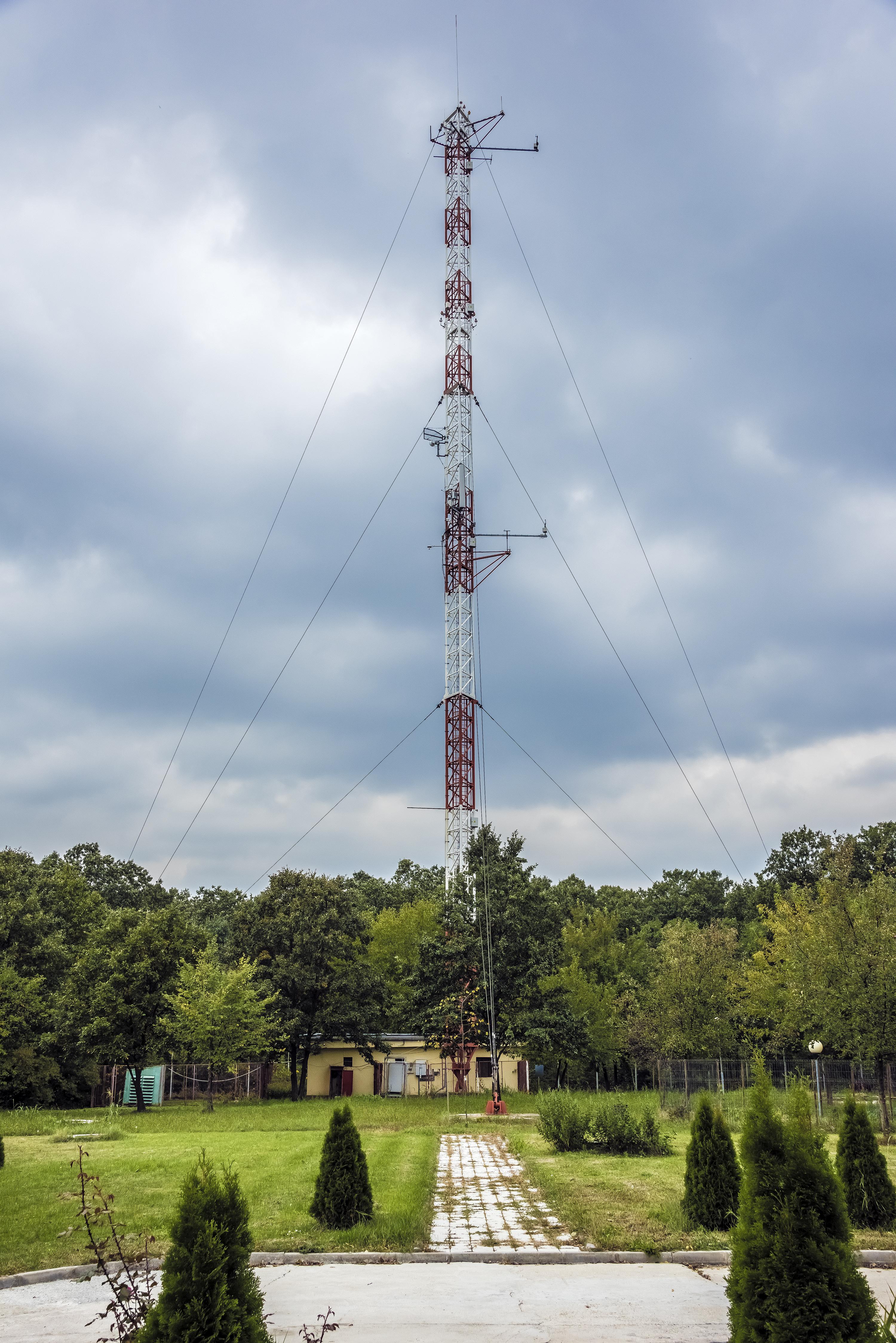
The radioactive products of very low activity are emitted from stacks of 40 m height and the effective source height is between 44 and 55 m.
The meteorological tower has the highest measurement level at 60 m and the intermediate measurement level at 30 m.
Due to restrictions in national regulation, the meteorological tower was build on IFIN-HH property, nearby a forest and surrounded by buildings.
The Tower was built beetween 1994 and 1996 with contribution from the Romanian Government and IAEA Vienna (providing meteorological sensors).
The tower is located nearby building 33 on the IFIN-HH area.
The minimum distance to forest border is 360 m (West direction) and the maximum is 1240 (East direction). The heights of the obstacles around the meteorological tower are about 12-15 m. This is a situation of non-uniform roughness and the wind profile is strongly disturbed.
The classic approaches in the literature do not allow a robust assessment of the atmospheric stability in such conditions. Consequently, the research studies dedicated to nuclear meteorology must be carried out for urban and sub-urban areas.
The meteorological tower worked with 2-3 levels of measurements in 1998-2000, with 7200 hours of good performance.
During the time when the met tower worked on-line in real time, it provided useful information for decision support system in case of nuclear emergency (EU RODOS project).
After a period of financial constraints, the tower was refurbished in 2007 and restarted its operation at the end of 2008.
Using the resources provided by an international project, RADO (Romanian Atmospheric 3D Observatory), financed by the Innovation Norway, various upgrades were done (ceilometer, net radiation sensor, sonic anemometer, infrared gas analyzer, radon monitor).
Afterwards, National Agency for Scientific Research provided the financial resources for the next on going upgrades (the present weather sensors, high precision and robust sensors for temperature, humidity and wind, as well as fast sensors for eddy covariance).
Finally, the system must assure all the surface information needed in nuclear safety.